


// Transform Reality Capture Operations With Next-Gen 360 Mobile Mapping.
Transform Reality Capture Operations With Next-Gen 360 Mobile Mapping
Experience the edge of tomorrow with our best in class turnkey systems, powered by Nvidia edge computing.
- Complimentary needs analysis & solution design.
The Vertex Advantage Transforming Mobile Mapping
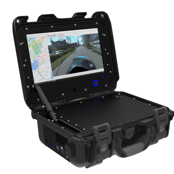
Plug and Play Mapping: Anywhere, Anytime
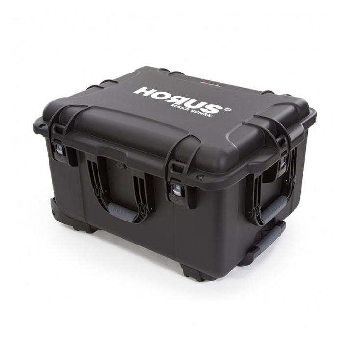
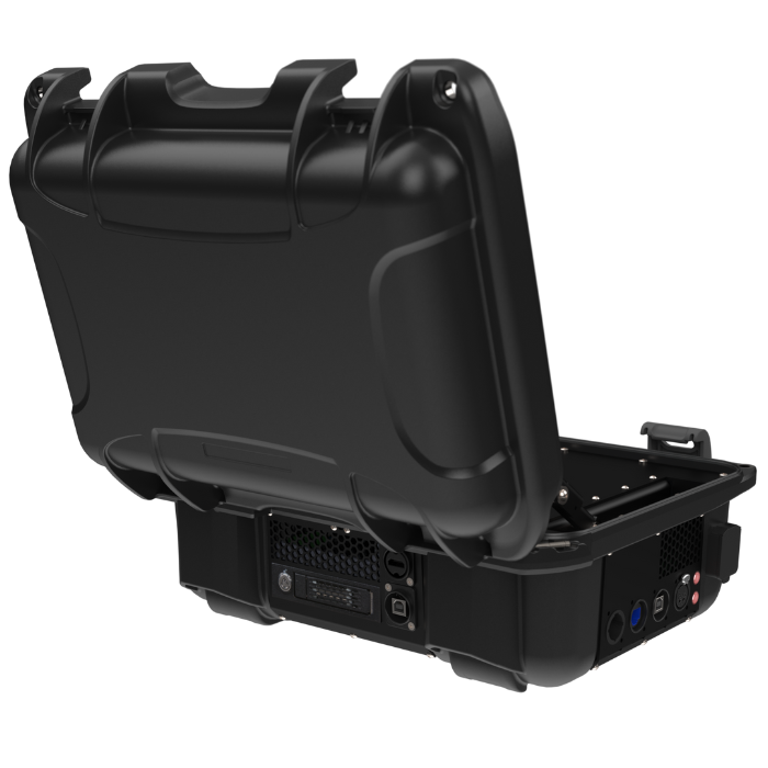
Integrate seamlessly with your existing fleet through universal Thule mounting and single-cable setup. The compact design fits easily into a travel case, enabling quick transitions between sites while keeping your teams agile and productive on every mapping project.
Real-Time Data, Instantly
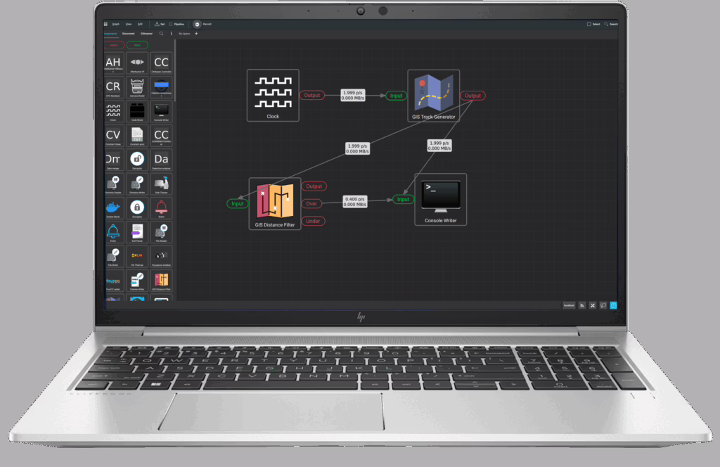
Our NVIDIA-powered processing eliminates traditional workflow bottlenecks with instant JPEG conversion and image stitching. Process your mapping data as you drive, while dual SSD backup ensures everything is secure and ready to use the moment you finish collecting.
Your System, Your Way
Build the system that matches your needs through the modular design. Choose your camera setup and integrate with your preferred software stack. The adaptable framework lets you configure exactly what you need while maintaining reliable performance.
Reliability You Can Count On
Count on dependable operation with globally available components and centimeter-level accuracy. Energy-efficient design enables full-day mapping runs, while single-person operation and comprehensive support keep your teams moving forward
// System Components & Technical Capabilities
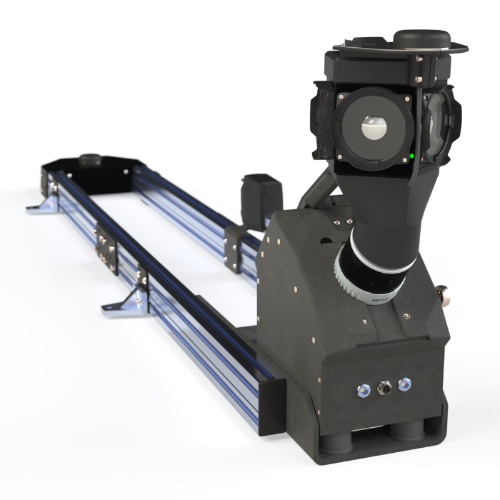
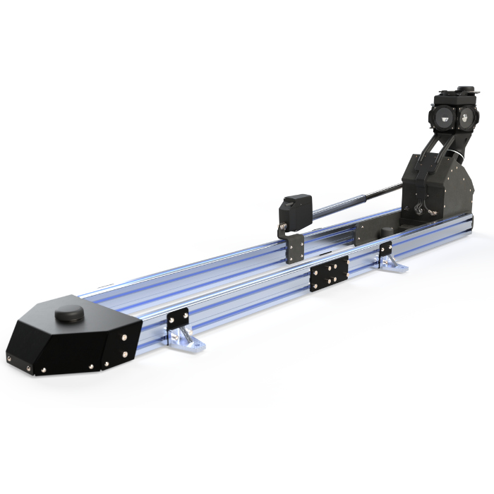
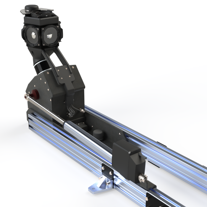
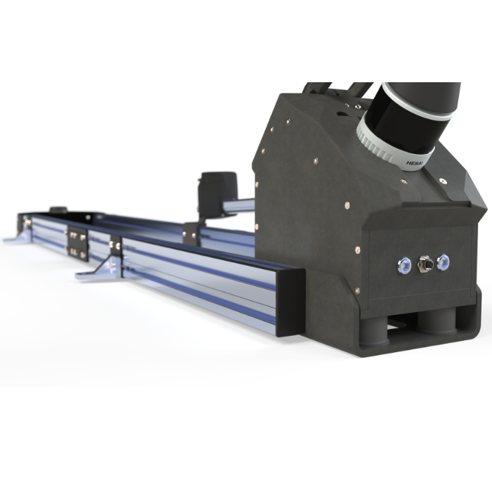
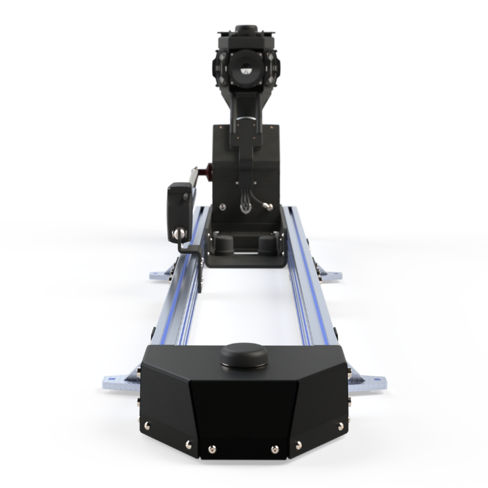
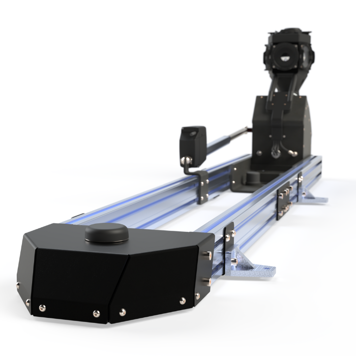
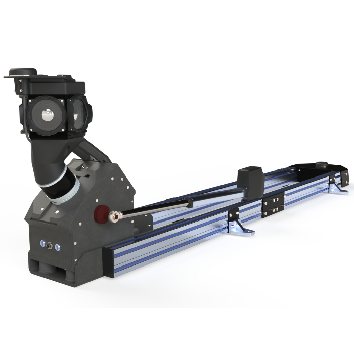
Inside The Vertex
The Vertex combines advanced mobile mapping with exceptional versatility in a compact design. Built for professionals needing superior image quality and efficiency, it delivers powerful capabilities in a portable package. Its smart architecture and real-time processing simplify complex workflows, letting you focus on results instead of equipment.
// Flexible Integration
// Processing Core
// Smart Design
// On-Edge Solutions
Flexible Integration
// Support multiple camera types including Ladybug 5+/6
// Future-ready extensible architecture
// Software framework compatible with exisiting systems
Processing Core
// NVIDIA-powered real-time data processing
// Dual SSD system with automatic data replication and QC
// Independent head unit/data logger for enhanced reliability
Smart Design
// Expandable distributed architecture
// Single Pelican case portability
// Garage friendly foldable mast with low wind profile
On-Edge Solutions
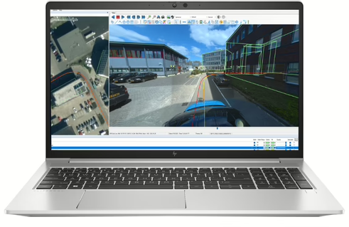
// Instant JPEG conversion for immediate access
// Real-time stitching with multiple projections
// Privacy compliant on-vehicle anonymization
Mapping Excellence in Action
Setup Time Slashed by 78%
“Thanks to Horus’ turnkey systems we reduced our setup time from 90 to 20 minutes, which also allows us to grab more mileage, earn more money and complete projects fast.”
")
Marco Scotton
Fieldmanager, Novotecni (Spain)
Processing Petabytes Without Limits
“At MasterMind, we leverage the LadyBug6’s advanced 360° technology to efficiently process petabytes of road data across our 10,000+ mile coverage per vehicle. By eliminating stitching needs, we’ve dramatically accelerated our post-processing capabilities—delivering faster, more accurate results for our clients.”

Nick Hickman
CEO, Mapster (USA)
Discover Your Path to Success
At Horus, we’re committed to your success from day one. Our comprehensive support journey ensures you’re fully equipped to maximize the potential of your Vertex mobile mapping system.
// Onboarding Milestones
Supported at Every Step

System arrival
The pre-tested Vertex system arrives fully equipped and ready for action, ensuring optimal performance and reliability right from the start.

Remote Training
Our experts provide hands-on training via video call to guide you through essential functionalities.

Software Onboarding
We assist you with software setup to optimize your experience from the beginning.

Ticket System
Our support team is just a ticket away, ready to resolve any issues you encounter.
Data Flow Process
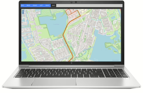
We begin by understanding your unique path from raw data acquisition to actionable intelligence. What are your final deliverables? How do you prefer to work with imagery and LiDAR datasets? What’s your optimal workflow for generating GIS products that truly unlock location insights?

Step 1: Record Data
Together, we determine the optimal data format (JPEG panorama/cube map, PGR, Horus native, or LAS/PCAP) for storage, eliminating unnecessary conversions downstream and streamlining your entire processing pipeline.
Step 2: Enhance Trajectory
Whether you need real-time corrections applied on-vehicle or prefer post-processing PPK workflows to optimize trajectory accuracy, we’ll architect the solution that best fits your operational requirements and quality standards.
Step 3: Import Data
Following comprehensive data validation, we collaborate with you to seamlessly integrate datasets into your existing workflows—or demonstrate how Horus software tools can maximize the value extraction from your mobile mapping campaigns.
Frequently Asked Questions
How quickly can we get the system up and running on our vehicles
You can have the system fully operational in just 20 minutes. Thanks to the universal mounting system, a single cable, and straightforward installation, one person can complete the setup quickly and easily! No special tools or additional personnel required.
What's the real-world accuracy we can expect from this system?
You can expect reliable, centimeter-level accuracy, supported by continuous real-time quality control to ensure consistent performance in everyday operations.
Can we add new sensors or capabilities as our needs change?
Absolutely. The modular design allows you to seamlessly integrate additional cameras, LiDAR, and other new capabilities as your needs grow.
What makes this better than our current mapping solution?
This system stands out due to its 78% faster setup time, instant data processing, and efficient single-person operation, allowing you to deploy and use it with minimal resources and downtime. Unlike many traditional or competing solutions, it combines rapid deployment with real-time insights, streamlining your workflow and boosting productivity. Its intuitive design and operational simplicity also reduce training time and operational costs, giving you a clear advantage over both your existing setup and alternative market offerings.
How quickly can our team become proficient with this system compared to other solutions?
Your team can be fully trained and ready to map after a streamlined two-day remote training program, significantly reducing onboarding time compared to most industry alternatives.
How well does the system integrate with our current software platforms compared to other solutions?
The system features a flexible framework designed for seamless integration with your preferred software stack, ensuring compatibility and minimizing disruption. An advantage over many less adaptable alternatives.
Can the system be tailored for different industries or specific use cases?
Yes, the modular design enables you to configure and customize the system precisely for your market application or operational needs, providing greater flexibility than most standard, one-size-fits-all solutions.