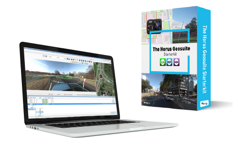
Introducing GeoSuite, the comprehensive solution that empowers you throughout the entire process of capturing imagery, preparing data, and extracting features. Whether you already collect your own street-level imagery or need assistance in acquiring it, GeoSuite has got you covered. With its user-friendly desktop software designed to run seamlessly on MS Windows, GeoSuite brings efficiency and effectiveness to your workflows.
The comprehensive solution that empowers you throughout the entire process of capturing imagery, preparing data, and extracting features.
Capture street-level imagery
Convert street-level imagery
Localize, measure and create GIS
// About GeoSuite
Capture street level imagery
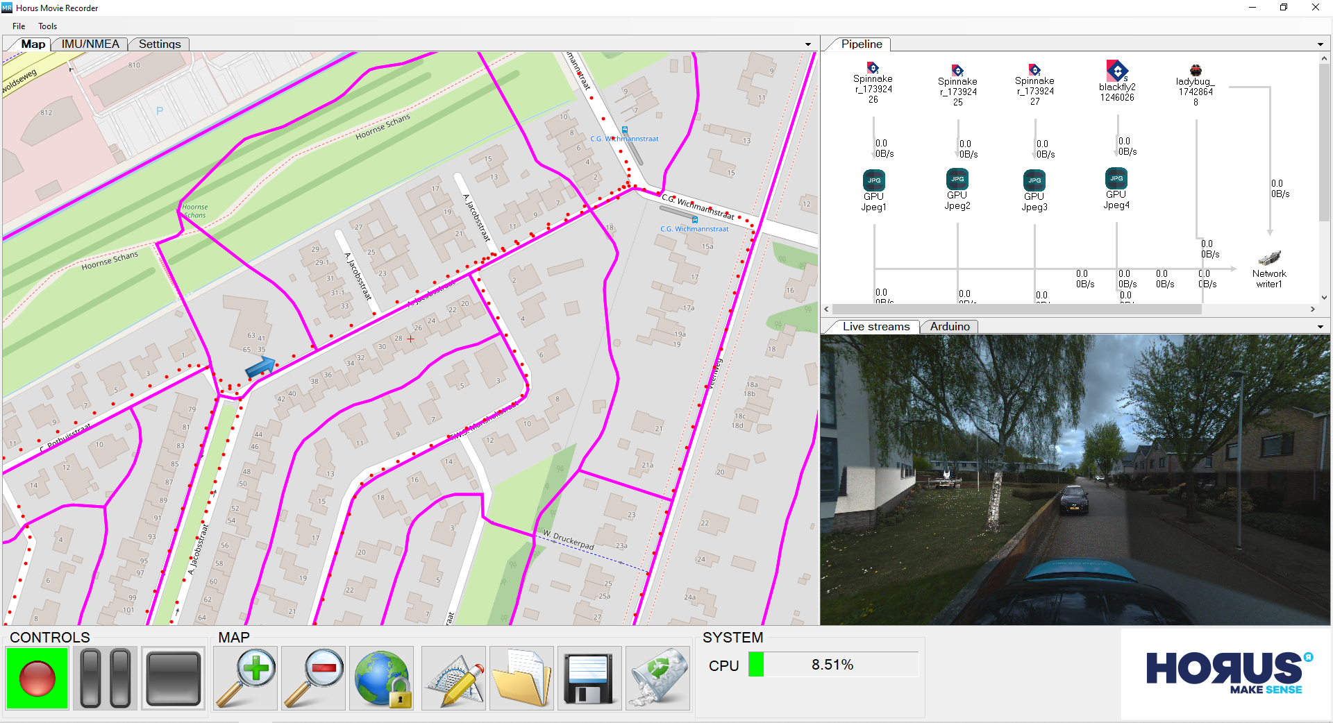
The Movie Recorder is the basic toolset to capture and collect sensor data out of your mobile mapping system.
The Recorder captures and synchronizes the several camera streams, GNSS data and other input streams simultaneously.
Movie Recorder functionalities
supports all kinds of cameras and GNSS/GPS systems, there is no need to invest in new hardware or easy to switch to new hardware.
has several QA/QC tools built in to analyze the data to find possible hardware issues
has a user friendly configurable GUI for the operator, to support a secure and efficient recording process (preview cameras, satellite info, offline maps, jobs to do/done via GIS vector data)
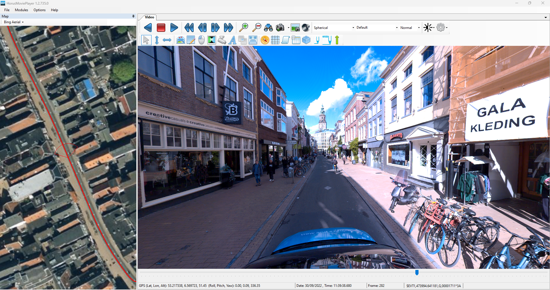
In case having your own street level imagery available, you can prepare this imagery data with GeoSuite for further processing.
GeoSuite functionalities
enables to import and assign positioning files. Even directly on top of your PGR or JPEG data!
updates your imagery data with the postprocessed GNSS trajectories. We made it easy for you to process this in batch mode.
exports data to all kinds of image formats or imagery re-projections for further usage in other software tools. (including equirectangular panos, orthophotos, cube maps, multi-res … etc).
Movie Maker
// Manual or automated mapping?
How to make maps from more than 1000 kilometers of street street-level imagery?
Some use cases are better off using desktop software to keep making their maps. Large volumes of images and repetitive questions can benefit from automated map making. Want to know what’s best in your situation?
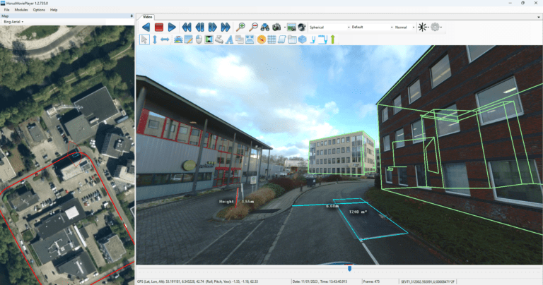
Do inspection or inventory tasks safer and faster from the office, and add quality and knowledge sharing.
Key functionalities in feature extraction & annotation
Overlay existing GIS on top of your street level imagery and detect anomalies quickly
ability to integrate several camera streams into one spherical view
Powerful geotagging & industry standards like SPATIALITE, GeoJSON and *.shp are supported
Add or update geometries and attribute data.
The output of your inspection or inventory is part of a real digital transformation: create GIS data to support asset management task better and more precise.